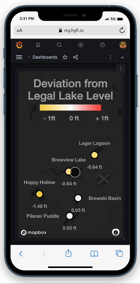
Keep up with lake levels

Map showing lakes with labels indicating water levels relative to summer level: Yellow Lake 0.5 feet under, Green Lake 1.5 feet above, Orange Lake 2.5 feet above summer level.
Dashboard showing deviation from legal lake level for various water bodies, with color-coded scale from -1 ft to +1 ft.

Quickly check lake levels from your phone or computer.

Know when levels deviate from legal with real-time alerts.

A body of water with a real-time water level sensor mounted on a bridge. Color lines (red, yellow, and orange) are painted across the wall's surface indicating water level thresholds.

Cellular lake level monitors included. Automatically provisioned. Reports 24/7. Access data anytime.

View of a lake shoreline with trees, two boats, and a dock. The shoreline is marked with a yellow line for the water edge and a red line indicating the higher land area. The camera shows a real-time Hyfi water level monitoring tracking the water.

Transparency through data for residents and regulators.

Map showing a large storm event hitting a network of Hyfi wireless water level monitors in Ohio in July
Graphs showing water depths at four different lakes labeled Orange Lake, Green Lake, Blue Lake, and Yellow Lake, with an option to export data to Excel. Automated lake level management reports and tracking.

Stay up to date with weekly summaries sent to your email.

Specifications

Pricing

Made in Michigan